Belle Ellen
Cahaba Coal Fields |
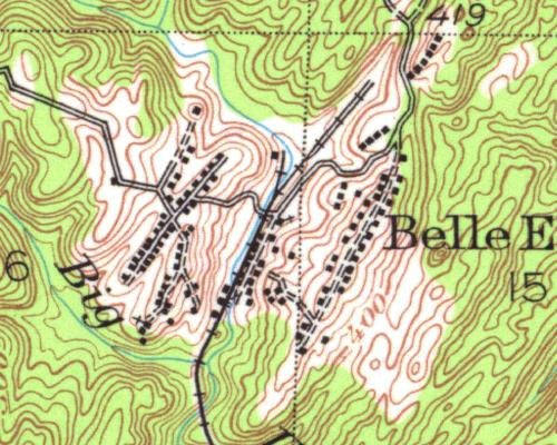
1934 USGS Map |
 |
 |
|
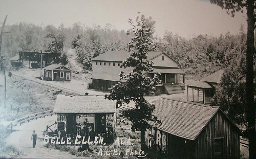
This picture helps to put Belle Ellen into perspective. The station is on the left, and the tipple appears in the background left. The large building in the center certainly appears to be the always present commissary, a part of every company town. Note on the map that the railroad service to Belle Ellen is a spur track, from the Southern Ry. mainline. (Goggins collection).
|
|
Previous Page |
Next Page |