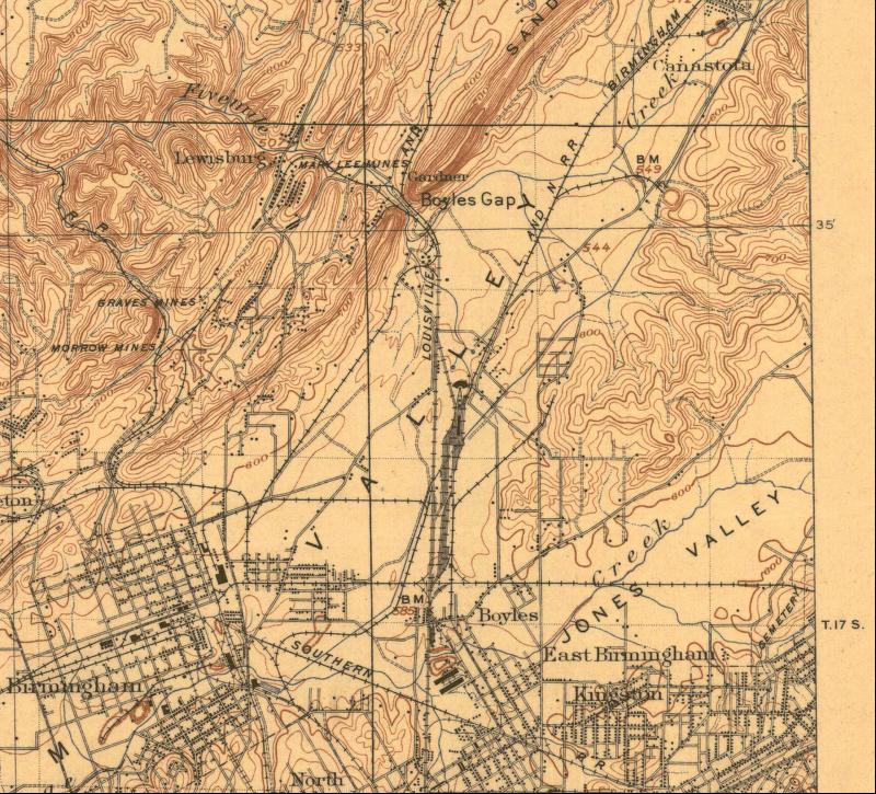
1906 Mapping of the Mary Lee Railroad Area
 |
|
1906 15 minute USGS Map of North Birmingham and the Boyles Yard (L&N RR) |
|
Lewisburg Mines show near the top of the map along Five Mile Creek. Mary Lee RR is not labeled, but is route to the Mary Lee mines at Lewisburg. |
|
Previous Page |
Next Map North |