Mary
Lee Mine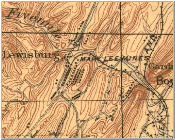
1906 Map
This is a detail from an 1906 USGS map and is far more detailed than the previous maps. Of interest is that there is no branch line to the north of Five Mile Creek.
This shows the general location of the mines, a mine "camp" village, and most likely battery coke ovens along the Stout's Road.
At this point it is not clear whether there were several mine openings in the area or not. Nor is it clear where any mine slope was located.
The key feature here is the curve of the RR line next to the word "Mary" as this can be followed clearly in newer maps.