Newcastle Coal Mines
New Castle Coal Company

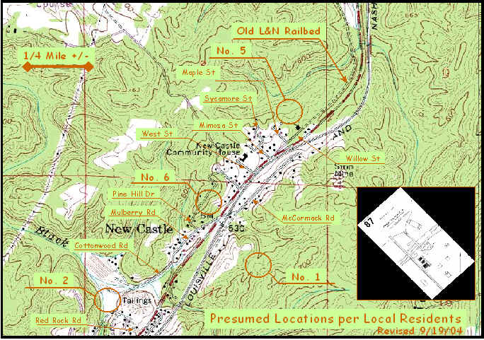
This is a USGS view of the Newcastle area showing presumed mine locations. These are based on Mr. Weeks discussions with local residents, and are general at best.
The map location of the community house is not the same building shown in the
Village photos in this website.
The location of the No. 1 Mine (Milner Mine, 1902) has been moved again. This time, it is based on the terrain and the likely location of a rail spur shown on the 1892 and 1897 maps of the area, as well as the 1906 location of structures at this location.
Note that the railroad bed of the L&N was relocated about 1914. The "Old L&N Railbed" above is the old mainline to Decatur, that followed Cunningham Creek north from Newcastle to Morris. This line was relocated to the east, and then followed Turkey Creek, connecting to a former spur line through Indio (mines) to Morris. Piers of the original line may be seen south of Morris.
It seems to be apparent that there was a parallel rail line, in the Newcastle area -- it is presumed that this line was built by the Milner company before 1900. This line shows on the 1906 USGS maps extending from Five Mile Creek area to Newcastle. Other maps show various spur tracks from the L&N mainline in the area.
Birmingham Rails would welcome specific comments from visitors that have detailed knowledge, maps or other information that would pinpoint these locations.