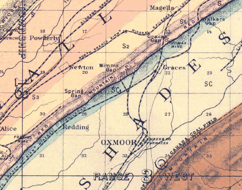
This map is dated 1890, and was prepared by Joseph Squire, through the State Geologist's office at the University of Alabama, and listing Ass't State Geologist Henry McCalley. Squire and Michael Toumey maintained an active business relationship for years including the period of this map, and it appears that Squire was serving as a subcontractor to the State Geologist's office -- outsourcing is not new. [Squire papers, BPL Archives]
One of the things that is interesting is that the development of the Red Mountain mines at Ishkooda had apparently not occurred by the time this map was prepared. Comparison with the 1913 map on the previous page shows that numerous mines were opened along the north face of the mountain, numbered up to "Ishkooda No. 15". However at this time, the Fossil and Alice mines on the north face of the mountain indicated the extent of development in this area. The Redding and Eureka mines were located on the south face of the mountain and appear to be the only mines in the area that were located south of the crest of Red Mountain.