Sayreton -- 1950's through 1970's
|
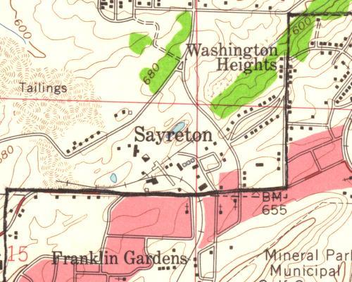
This is a USGS map of Sayreton in the 1950's (map date 1959). The plant shows the basic configuration the same as the 1928 map on the previous page. |
 |
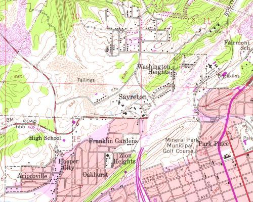
| This
is a USGS map of Sayreton dated 1978. Although the basic
configuration of the rail spur has not changed, one can see that the
interstate (I-65) is shown under construction.
In the early 1990's there was a concrete structure at this location, just west of the interstate interchange, which was likely part of the Sayreton plant. Like so many reminders of Birmingham's past, one day it too was gone. The author would certainly appreciate any photos or other images of Sayreton plant to share with Birmingham Rails visitors. |
 |
Previous Page |