Newcastle Coal Mines
Map Study (All maps from UA Map Archive)
There are several questions that I have been working on regarding Newcastle. First, what was there, and where were the mines located. Second, the location of the community, the roads and the rail lines -- these seem to have changed. For example, the L&N main line was relocated in this area, and there was a "second" rail line serving the mines that paralleled the mainline back to Cane Creek branch to the south.
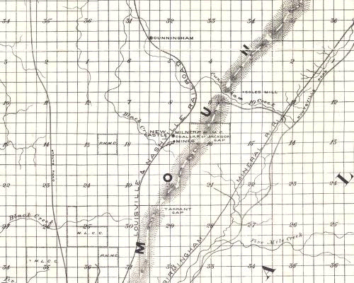
| Greig's 1889 Map
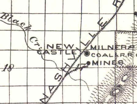
Note this map shows "Milner Coal & RR Mines" in land section 17, at Newcastle. Note the location of the rail spur, starting at Black Creek and going northeast.
|
 |
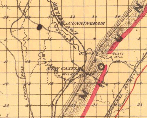
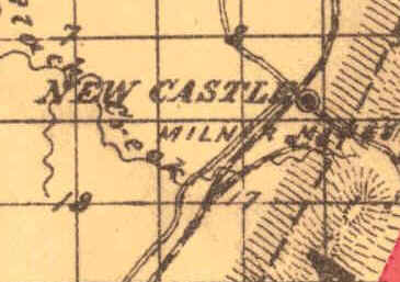
| Schoel's 1892 Map
Note this map shows Milner Mines, and a rail spur, in land Section 17, at Newcastle.
|
 |
|
Miller's 1897 Map Note this map show "Millers" (sic) Coal Mine, and a rail spur starting at Black Creek similar to the maps above, in land Section 17. |
 |
|
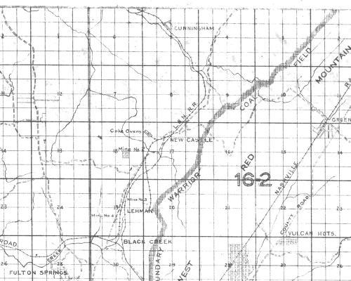
1906 USGS Map Note the rail spur to the east of the main line and compare to the No. 3 spur in the next map down. Also note the structures, and lack of a rail spur below the "w" in Newcastle. This is believed to be the location of No. 1 Mine site. |
 |
|
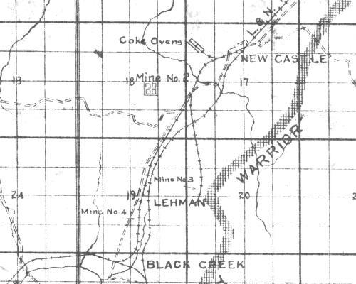
1908 Coal Operators Map Compare this map and the ones above. There is a general correlation of the track layout on this map and the 1906 map. This map confirms the location of the No. 2 Tipple at Black Creek Hollow. It does not give an indication of plant no. 6 shown in later photos. |
 |
|
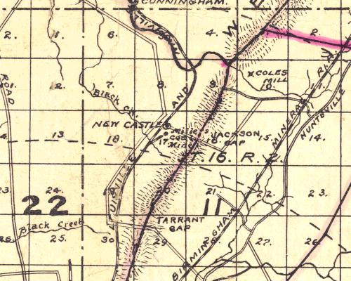
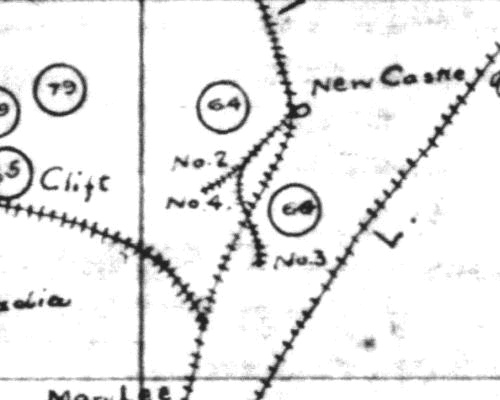
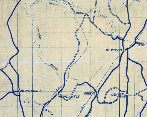
Cox's 1913 Map L&N Main line still follows Cunningham Creek on this map (see below) Note this map clearly labels mine No. 2, No. 3, and No. 4. There is no reference to No. 1, No. 5 and No. 6. |
 |
|
Cox's 1913 Map L&N Main line still follows Cunningham Creek on this map
|
 |
|
TCI Land Dept. 1916 Map Note that this is the first map to show the realignment of the L&N Main Line away from Cunningham Creek Also note that the road crosses the L&N south of Cunningham Branch |
 |
|
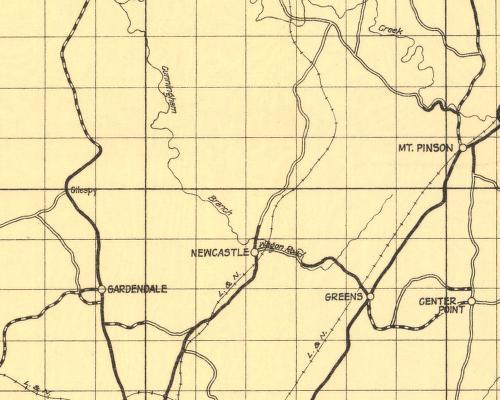
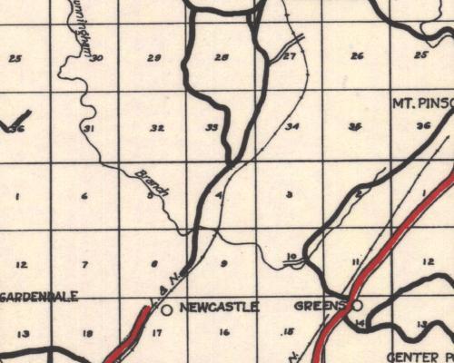
1922 Jefferson Co Note that the road crosses the L&N south of Cunningham Branch |
 |
|
1927 Jefferson Co. Note that the road does not cross the L&N south of Cunningham Branch It is believed that the road was relocated about 1925. |
 |
|
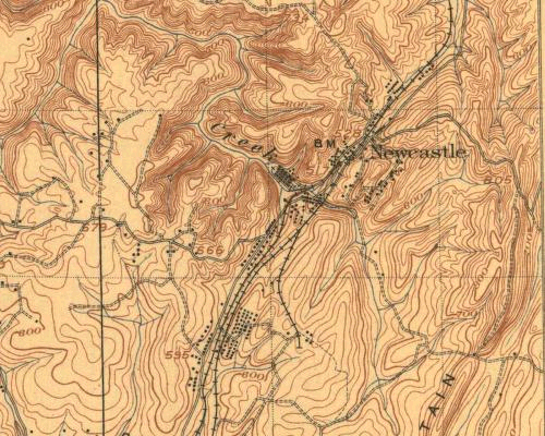
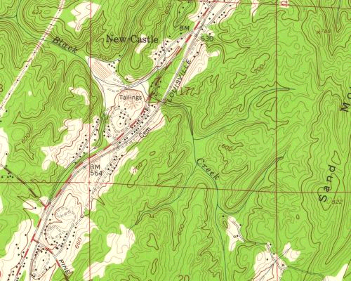
1959 USGS Map (Newcastle Coal Company ended operations about 1950) |
 |
Maps - 1889 to 1959 |
Mines and Structures |
The Village - About 1925 |
Trains at Newcastle |
Understanding the Changes |
Locations over the Years |
Newcastle Introduction |
Navigation Page |